09/27/2017 to 09/30/2017
At last the weather has cooled enough to enable us to make a trip closer to home.
We have wanted to do Escalante for some time, just never fit into the schedule until now.
Aside from the incredible formations and vistas, the area has another feature we love; lots and lots of dirt roads. Our friends can attest to our fondness for unpaved, washboard, rutted, bouncy routes.
Another great thing about this trip was we finally got to drive Cottonwood Canyon Road. This is a shorter route from Arizona to Utah but it is considered impassible if moist - clay base under soft sand equals bogged down. So, since it is not too hot and it is very dry, CCR is now off our bucket list with a big star for another visit.
Guess there is a good side to global warming after all.
- Kodachrome Basin State Park
- Burr Trail
- Devils Garden on Hole-In-The-Rock Road
- Dinosaur Tracks - Hole-In-The-Rock Road
- Scenic Highway 12 - Escalante to Boulder
- Peek-A-Boo and Spooky Slot Canyons
- Grosvenor Arch - Cottonwood Canyon Road
- Cottonwood Narrows North - Cottonwood Canyon Road
The basin got it's name when some National Geographic Society folks were here in 1947 taking pictures for a September 1948 article. The colors were so striking they named it after the new Kodak film, Kodachrome.
There are a couple different theories on how the formations were created or exactly what made them, especially the tall pipes.
The bottom line is it is a beautiful place with lots to see and appreciate.

George out on a little ledge as we walked around Angel's Palace Trail

Love this pointy finger

The Tree of Woe - for all you folks who remember Conan. No vultures though


The sandstone formation and colors are always spectacular

Yup, i am out on a ledge looking lost

Actually this is what I am looking at from my lofty perch

In all that red this beautiful white sand pipe


Just scenery

Chimney rock. I am that little person at the base of the rather tall sand pipe

On to Shakespear Arch.

You walk a short trail to this formation


The arch


The road is named for John Atlantic Burr - he was born aboard a ship in the Atlantic ocean, thus the name - a cattleman who forged a route moving his cattle from winter pasture to summer pasture.
If you start from Boulder, as we did, the first 30 miles or so are paved. After that it is all dirt.
As with Cottonwood Canyon Road, if there is rain the dirt is impassible. Thankfully no rain.
The formations are just as spectacular as anything in the area.
Also there is a small slot canyon which was a lovely surprise.
Now we just need to start from Grand Staircase end and go back to Boulder. Good to have goals.

That is our sign

This cool stone rocket is outside the Hells Backbone Store in Boulder

The road along the bright red cliffs

Entrance to the slot canyon

The sandstone formations are dotted with holes


Rather artistic washouts in the rocks

Inside the slot canyon the walls rise above you

Sandy path into canyon
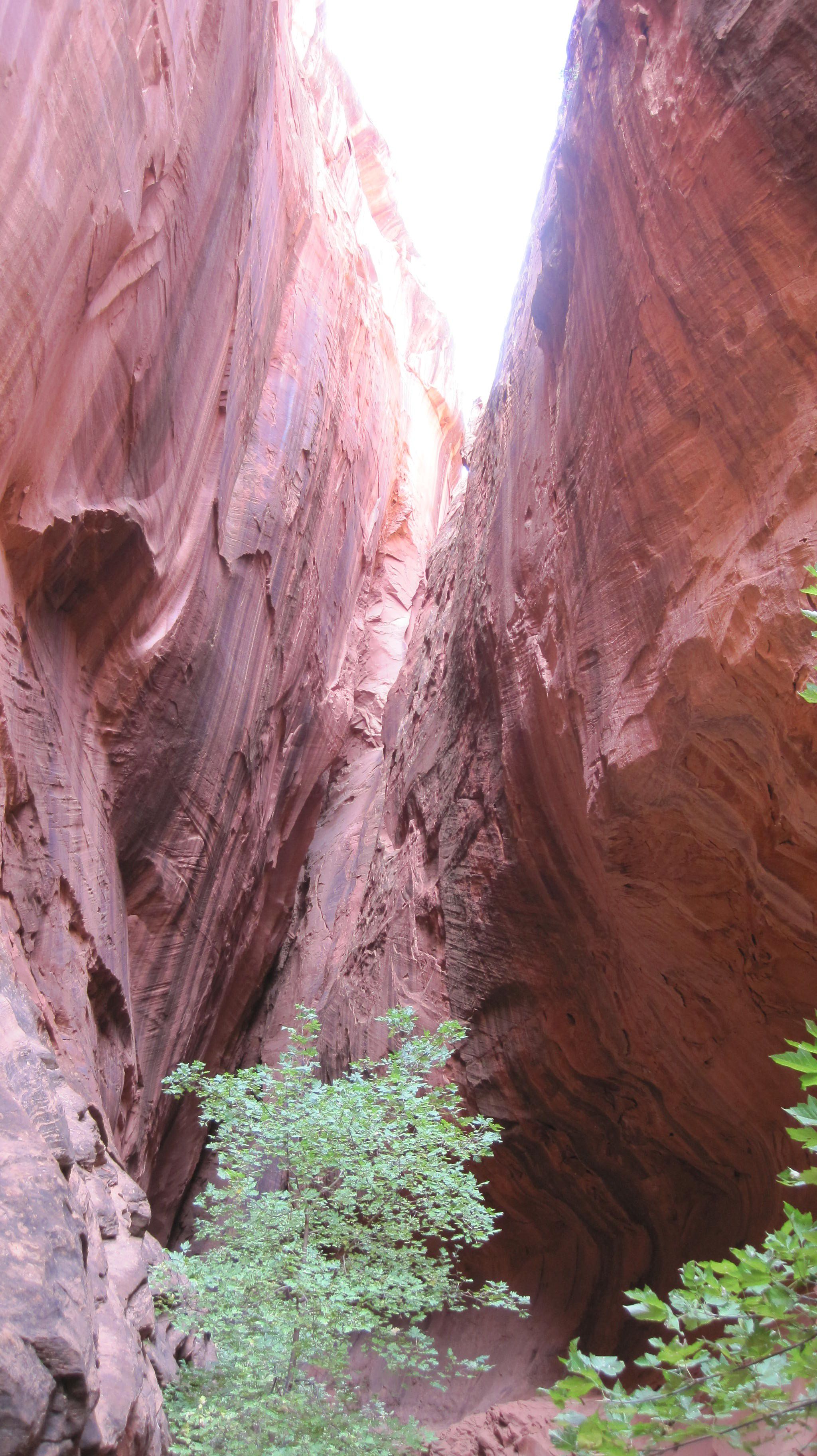

Looking back out as you enter the canyon


As you can see the walls are very high. George looks very small

Loved the colors


More road shots

There were a proliferation of these round, black rocks on this light sandstone hill

Reminded us of a bunch of rabbit poop - from a rather large rabbit

Looking at the windy road from above

Here is where the pavement ends and dirt road begins as you head toward Grand Staircase


Peek-a-boo Arch

Looking down on the winding dirt road
Another dirt road. Yeah!
This started as a cattle trail back in the 1870s or so. Today it is part of the monument with many interesting formations along the way.
We did not make it all the way down to the actual Hole-In-The-Rock so we have a reason to go back.
Devils Garden is not large but it is full of great spires and hoodoos. Lots of opportunities for climbing on rocks and great scenery.


Proof George does smile

I called these gnomes


Peek a boo

The only wildlife - a smiling lizard

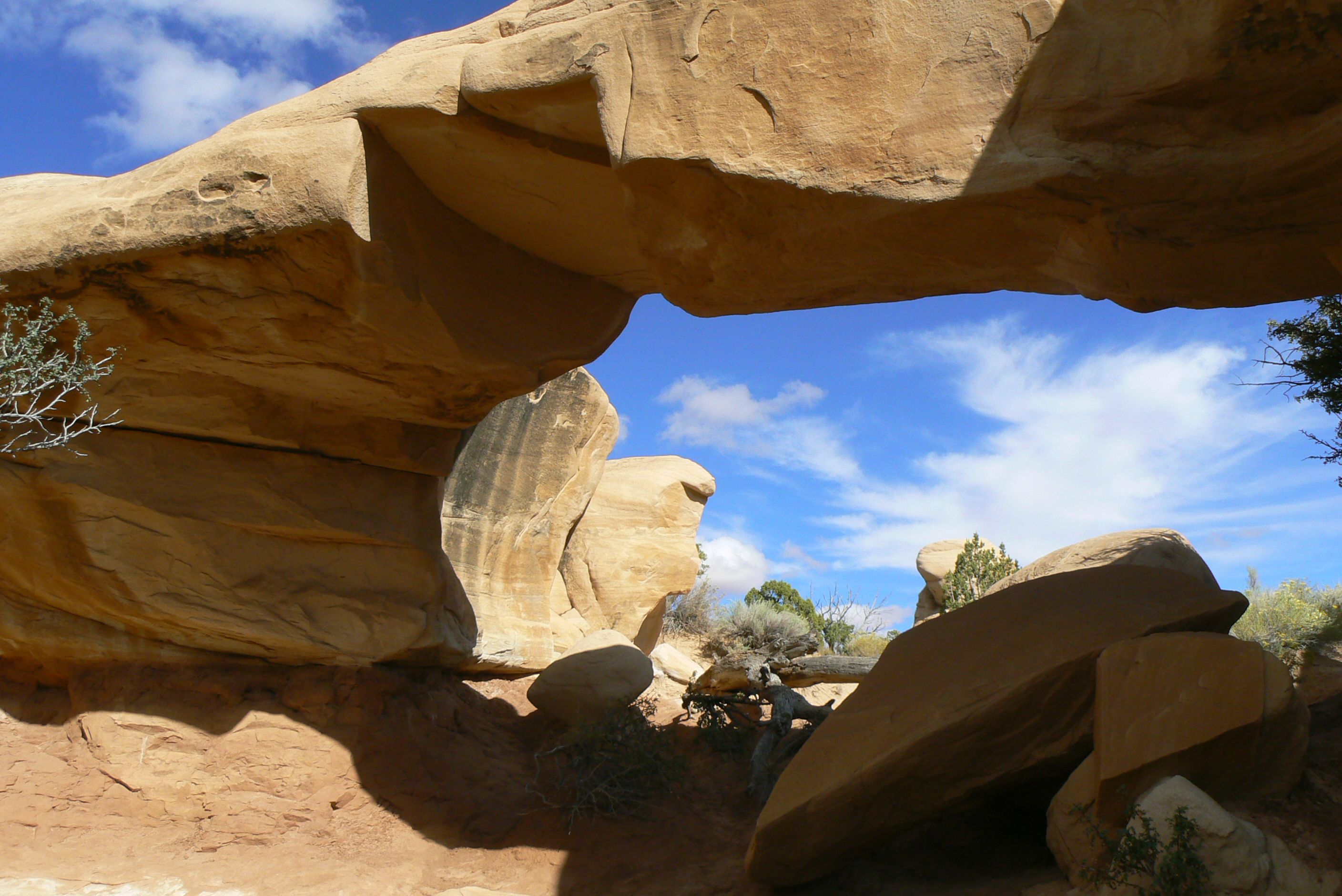
This is Mano Arch


George climbing on the rock

For some reason it reminded me of all the chimneys on row houses in London

But a lot prettier


Metate Arch

This is the one you usually see on post cards


To me this looked like a persons profile


I'm out there to give a little sense of scale

Spires


Toadstools

These tracks are high on a bluff of slickrock at 20 Mile Wash on Hole-In-The-Rock Road.
Getting there is a little tricky and the last mile or so was rough - which is why we have a truck - but quite doable.
Once you find the sign you start searching for the tracks. Now, I was looking for big feet with toes and claws like the ones near Tuba City so it took a while and some climbing to find them.
The tracks are of Sauropods and Theropods, so no toes and claws. They are also quite worn so it takes a bit to locate them, but once you find one the others are easy.

A little info on the site

The large bluff of Entrada sandstone


Just climbing on the rocks looking for tracks

AHA! A Track. That large, round slightly indented thing is a footprint

If you sprinkle some water it shows up much better

I am walking along the trail of tracks. Lots of footprints and tail drags

View of the valley and our truck from above

Me pointing out more tracks and tail drags

The Shadow People followed us again

More prints

And a few more. No idea which are Sauropod and which are Theropod. Just know they are bipeds

Nice view

Loved the streaks in the rocks
This is a beautiful road that winds its way between Escalante and Boulder. Lots of great scenery and curves along the way.
This section is known as The Hogback.
To quote from the Scenic Byway brochure "the asphalt clings to this thin razorback ridge of slickrock as the terrain spills steeply off to each side..."


After the dinosaur tracks we headed further down Hole-In-The-Rock to the Dry Gulch area and FR 252 to do two slot canyons we had heard about.
As with most of the road it was a little rough but not bad. The last half mile to the trail head was anything but easy. Our truck did just fine, but a car would have a lot of trouble.
The trail to the canyons is marked by cairns. First you descend a nice, tall slickrock hill, then head out into the desert.
Once you find the start of Peek-A-Boo you have the choice to do it or go on to Spooky. We chose Peek-A-Boo first.
We made an attempt at climbing the rock face entrance to the slot but it got pretty slick half way up so we came back down. Good sense prevailed - meaning George not me.
So we chose the lesser path around the cliff to pick up the slot.
The area is amazing and well worth the hike in and out. Just be sure to bring lots of water and really good shoes

Little info about the slots

Up there is where you start

As you can see at times it can be hands and feet getting down

The entrance to Peek-A-Boo. Once you wade through the thigh deep water you use hand holes to get up to the slot

Yup, after we decided to try another path this is what our shoes looked like - after we cleaned a lot of mud off

The alternate entrance. Bypasses the first part and the pool

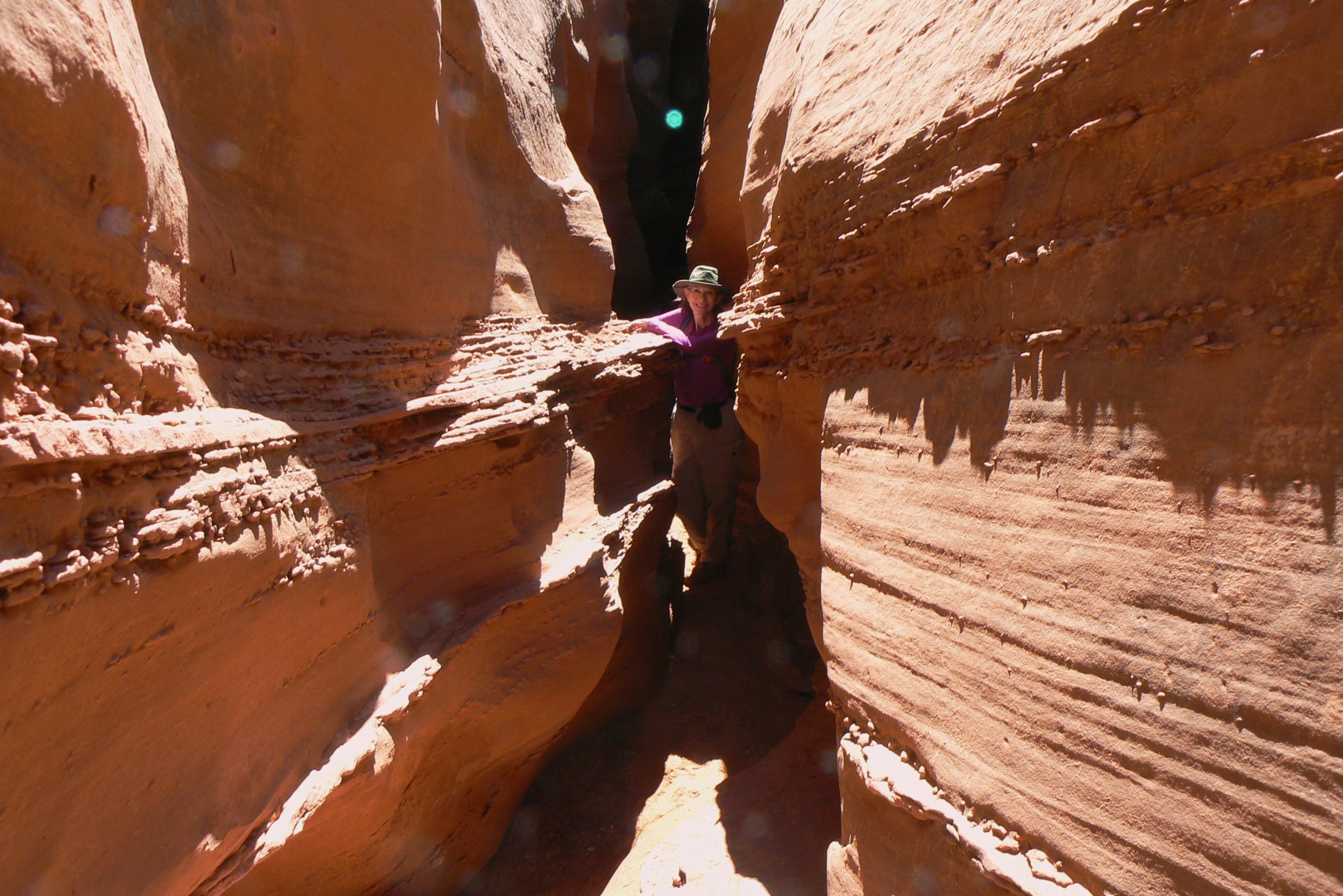
As you can see there are some nice tight slots - Hi George

And mud in many spots of the path

George trying to straddle the muddy path

Those folks are coming back from Spooky - skirting the rim

More squeezing

Just a nice shot of the slots


A wide spot in the canyon

Me hanging out

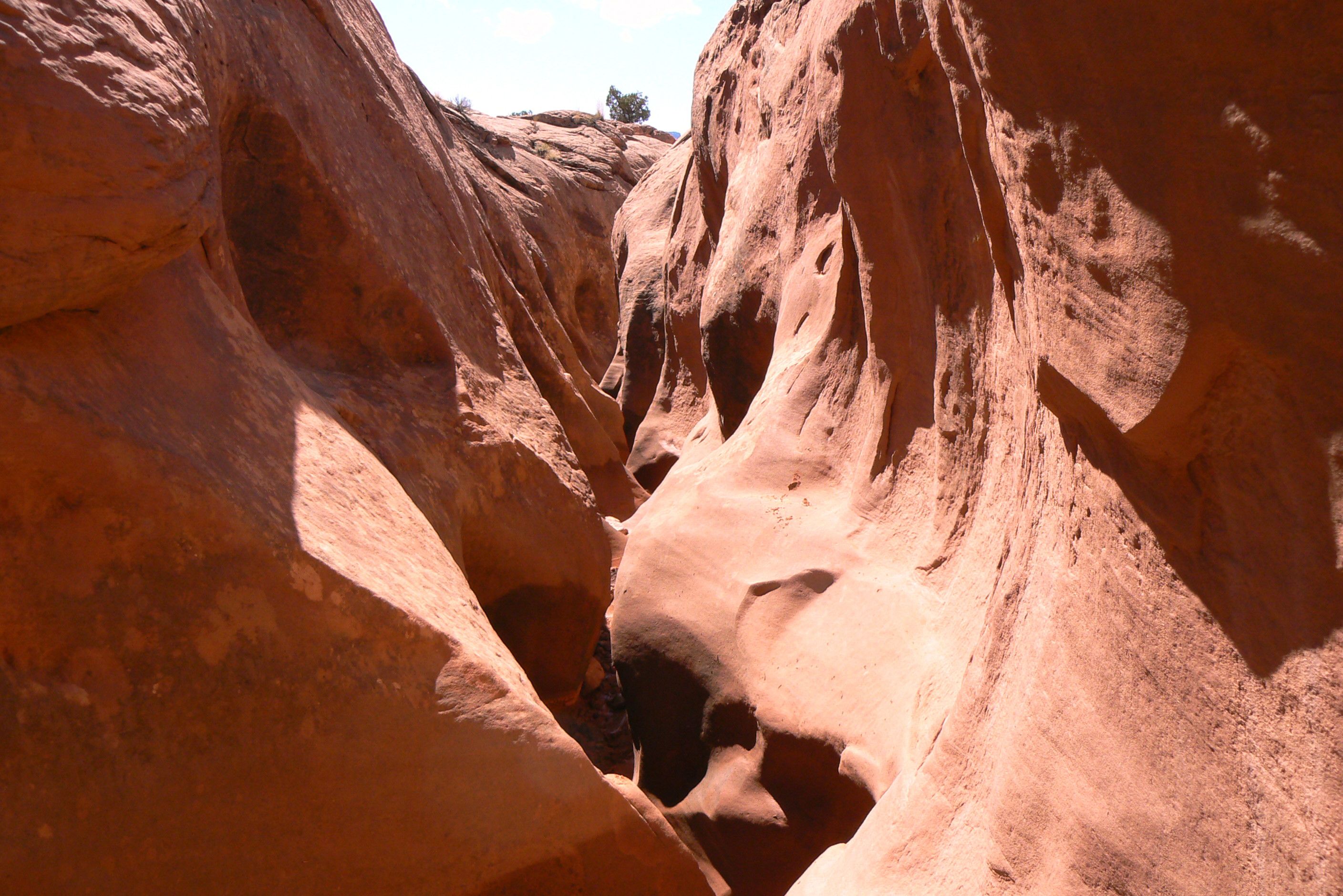
Now on to Spooky - so named because most of it is very narrow


There was a large rock in the trail which we climbed over


Just some shots of the walls


The colors varied depending on light

This rock was right over a descent to the remainder of the slot but we could not get down it. So end of Spooky

Now for the climb back out

After about 8 miles we were a little tired and the thighs and knees were not happy


At last the Cottonwood Canyon Road.
So today we are heading home and finally getting to do this road.
There are many places of interest on this road but we only had time for a couple.
Our first stop was Grosvenor Arch. Well, actually 2 arches but who is counting.


First glimpse of the arch

The nice path up to the base

And the arches


Walking around the side of the formation


From the back the sun was shining through the small hole

Looked quite lovely
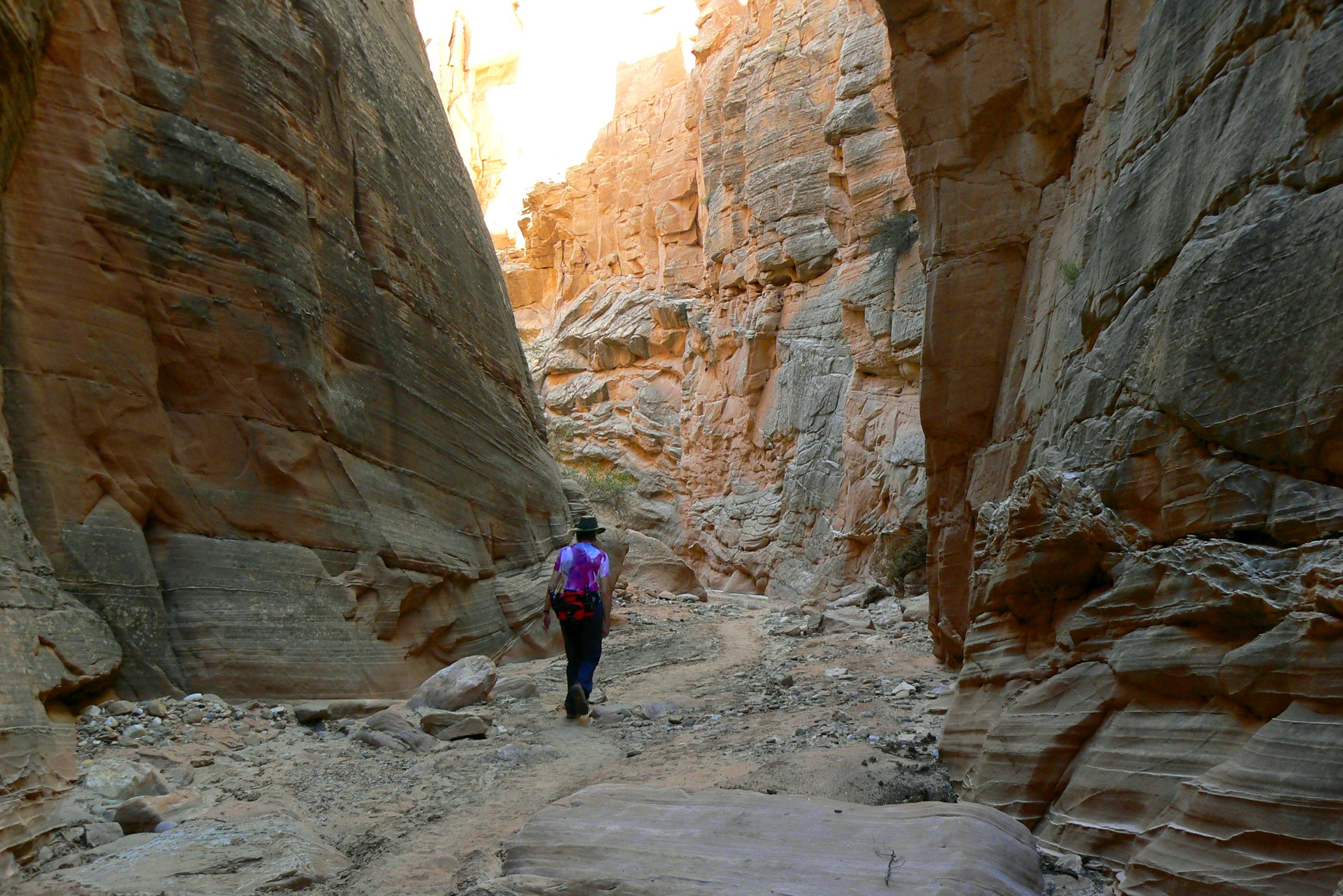
Our second stop along Cottonwood Canyon Road was a nice hike through the Narrows.
We started at the north end. Mostly it is flat sand meandering through a spectacular slot but there was at least one spot where we had to do some rock scrambling to get down.
Once you reach the exit you have a choice of either reversing your course back through the wash or walk back to your vehicle along the road.
We chose the road just so we could enjoy the scenery.

The sign for the start of the northern end of the trail

First glimpse once you go into the canyon

George is in for scale. Some idea of how high the cliff walls are

MUD. Yes, mud. The rains only ended a few days ago but some areas were very wet in here

The rocks are full of streaks and scars from debris washing down the canyon with great force


After we left the canyon at the southern end we walked back up the road to the truck

And as you can see the scenery was just beautiful.


